This post is the last part of my hiking adventure and about Daisekirinzan, the green-coded Subtropical Nature Forest trail is a trail leading through the jungle. And as I have mentioned before, this last trail, features my favourite tree, the banyan tree or known as the gyajumaru in Japanese.
I love the banyan tree, although this tree has an ill reputation and superstitions surrounding the beautiful tree. It is believed that the banyan tree is a home for the spirits. When I was young, I was warned not to play near the banyan tree.
Despite all that, the banyan tree became my favourite tree. I have admired the fact that its seeds germinate in the cracks and crevices on a host tree that will one day grow into a big supportive root. To me, this tree symbolizes strength to grow from nothing to independence.
Ever since, I left my hometown, I see lesser and lesser of this tree and I am so over-the-moon to see it growing big and strong in Daisekirinzan. Most visitors will walk this trail as the last trail as it is the only trail that connects from the first entrance near the car park. Or you can also start this trail first if you do not want to take the bus up to the rest area.
A dedication to the discovery of the most magical, hidden, and off-the-beat gems in the most accessible, but unexpected locales around Tokyo and Japan.
Showing posts with label Hiking. Show all posts
Saturday, 4 January 2014
Okinawa : Hiking in Daisekirinzan 2
Sorry, I haven't been able to churn out posts as fast as I wanted to (I wonder how others have managed it?). Well, as the continuation of Daisekirinzan, after the yellow-coded Strange Rock hiking trail, we continued on to the red trail named as the Panoramic trail. This trail is the most popular with visitors as it allows you to enjoy the view of Cape Hedo. And the name of the trail really convey its message - the view is really panoramic and amazing.
This trail was a sacred trail for the Okinawans as they believed that the gods lived here. You can try to find the half hidden rock shrine.
We took almost 40mins to finish this trail because we stayed a bit too long at the panorama platform. The views are simply gorgeous and we can't get enough of it. You just have to experience this personally because words aren't enough to describe the view.
| Lots of money to begin my new year with!!! |
Friday, 3 January 2014
Okinawa : Hiking in Daisekirinzan 1
After my unforgettable whale-watching experience, me and my travel partner drove up to the northern tip of Okinawa island for a hike. As usual, the 'hike' was really just a walk because the path is typically beaten and some even paved which I suspect it is for the adventurous high-heelers (I can never understand why young Japanese women refuses to wear proper boots for hiking? Not stylish enough, maybe?)
So, hiking in popular or well-known places in Japan usually means that you can actually wear high heels and 'hike'!
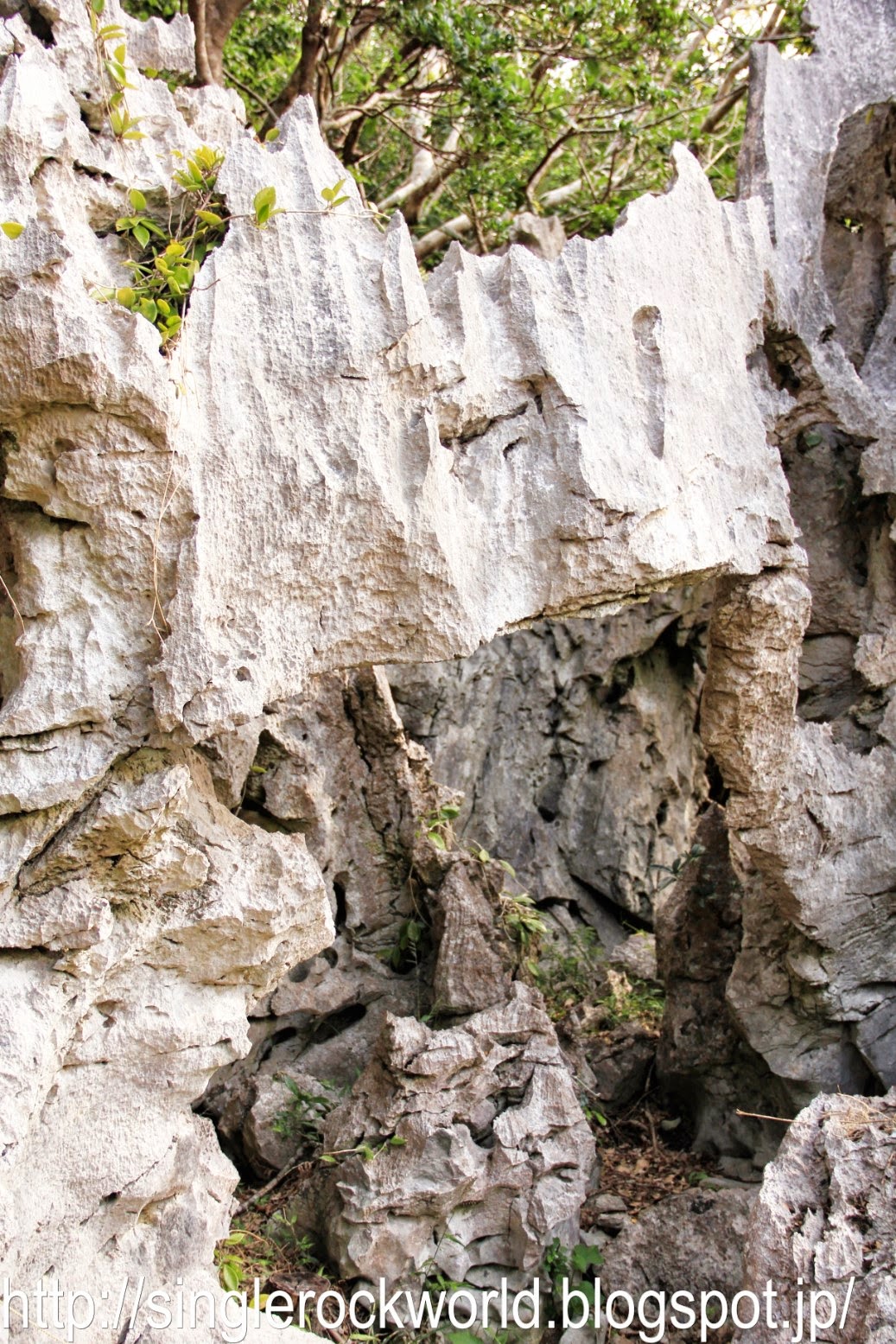
Anyway, Daisekirinzan is one of the popular hiking spots in Okinawa. It is an area made up of strangely shaped karst formed over millions of years. The geological formation by water and wind on soft limestone rocks form the karst found abundant in this area and it makes great landscape feature. There are four color-coded hiking courses; the Strange rock course, the Panoramic course, the Subtropical Forest course and one barrier-free course for its visitors.
At first, we thought that we are going to do just two courses, but after some thoughts, we figured out that we will have enough time to do all three courses as each course, just take about half an hour and still make it to another place that we are planning to go after Daisekirinzan.
Anyway, Daisekirinzan is one of the popular hiking spots in Okinawa. It is an area made up of strangely shaped karst formed over millions of years. The geological formation by water and wind on soft limestone rocks form the karst found abundant in this area and it makes great landscape feature. There are four color-coded hiking courses; the Strange rock course, the Panoramic course, the Subtropical Forest course and one barrier-free course for its visitors.
We started on the yellow Strange Rock course which features oddly-shaped limestone rocks. It seems to be the longest course and travels up into the hills connecting the red Panoramic course. Looks like a little more strenuous course compared to the other, but I think it is relatively an easy course to do.
Pretty fascinating and there were lots of explanation on how the rocks form (it is written in Japanese). On this course alone, we took about one hour to finish it as we stopped to read and to photograph the nature (my favourite!!!)
From the Strange Rock course, we were able to go on straight to the Panoramic course.
To be continued...
To be continued...
Sunday, 17 November 2013
Autumn in Yatsugatake Highland
I had a little escape from the city to the mountains and this time, I am in the Yatsugatake mountain range. The name Yatsugatake literally means the eight peaks in Japanese language. However, the mountain range of Yatsugatake has more than eight peaks so the word 'yatsu' here doesn't merely means 'eight' but also the nuance of 'many' in Japanese language.
There is a cool legend behind these magnificent mountain ranges. It was said that Mt Yatsugatake was once just one tall mountain, very similar to Mt Fuji and was protected by a god. This issue doesn't sit well with the proud goddess of Mt Fuji. It wasn't long before the two protectors started to fight over the two mountains' height. Each insisted that one is taller than the other. The Buddha who was the judge of this conflict created a gutter between the two mountains. He then pours water into the gutter and the water flows from Mt Yatsugatake to Mt Fuji proving the former being the higher one. The goddess of Mt Fuji was angry to be proven wrong and struck Mt Yatsugatake multiple times with her magic long stick till the mountain become a chain of jagged mountains range as we see today. I think the goddess may have done a good deed by making Mt Yatsugatake and its surroundings more stunning.
Although this area used to be a wasteland, but today, it is a popular summer resort known for its natural surroundings, wildlife and greenery. One can enjoy bird watching, cycling, hiking and even star gazing as it has been found that the terrain of this place offers wide flat land which allows a 360 degree view of the skies. Nobeyama is the place for some serious star observation. Some hotels also have its own telescope for its guest.
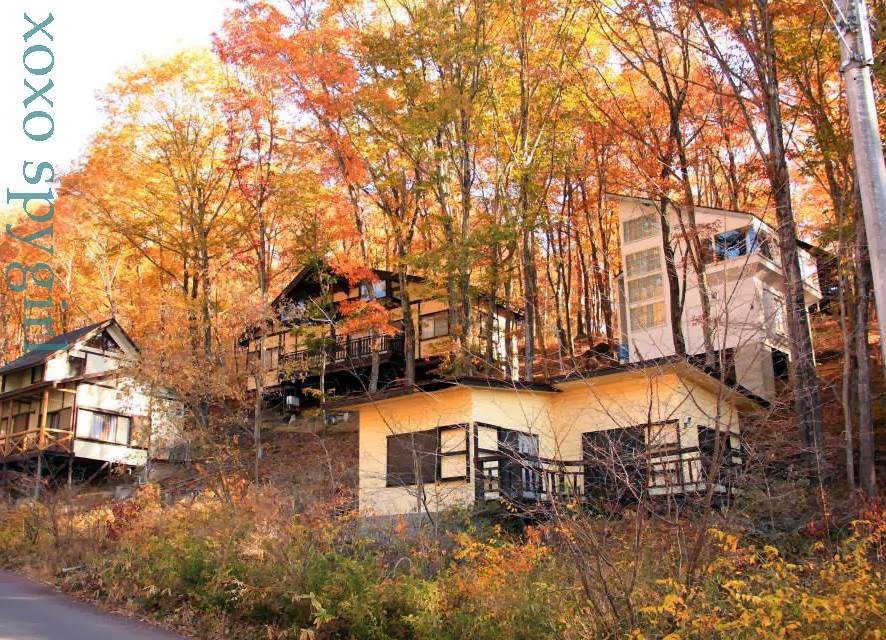
Walking around this area has been therapeutic with lots of quiet pathways to walk and very few cars. I guess this place is busy, mostly during the summer. Also, due to the infrequency of public transportation in this area, less people will travel here after the peak season. It is absolutely a wonderful place for nature lovers, as the cabins of Yatsugatake are located in the woods with awesome views.
Like I said, this place is a heaven for those who love walking and strolling and the landscape is best to savour if you are not rushing for time (why would you while in the mountains?). Probably, it is a good idea to travel with a car as you will be able to drive on one of the most scenic roads, the Yatsugatake Kogen Line Road. The best time is of course in late Oct till Nov.
If you are travelling using the public transportation like me, then, it is wise to check the schedule for the train and bus before you head out.
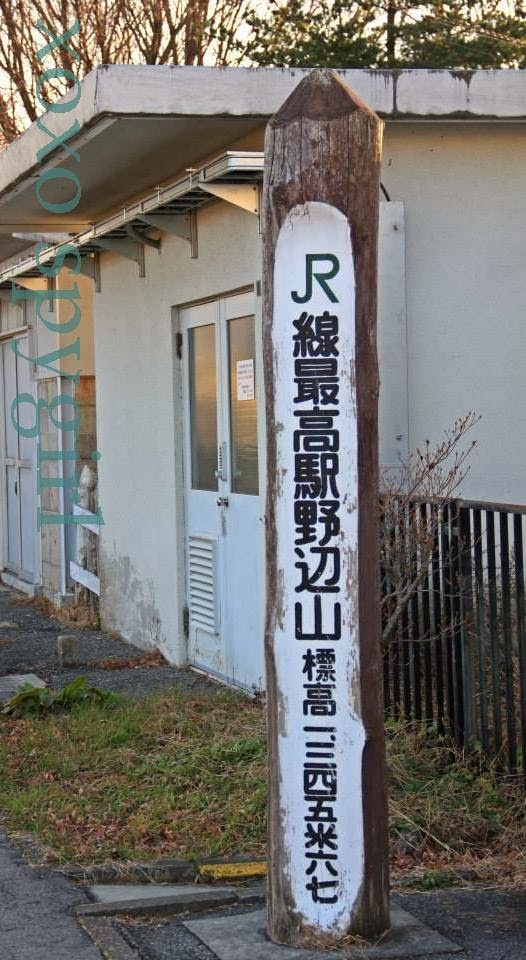
The JR East Koumi line is also known as the Yatsugatake Kogen line is one of the most scenic train lines in Japan. The line starts from Kobuchizawa station in Yamanashi-ken and ends at the Komoro station in Nagano-ken with Nobeyama station being the highest JR station in Japan. This train ride is a must-ride train ride in Japan.
Just bring your camera or your favourite drink on board, sit back and enjoy your ride through the mountains of Yatsugatake.
Although this area used to be a wasteland, but today, it is a popular summer resort known for its natural surroundings, wildlife and greenery. One can enjoy bird watching, cycling, hiking and even star gazing as it has been found that the terrain of this place offers wide flat land which allows a 360 degree view of the skies. Nobeyama is the place for some serious star observation. Some hotels also have its own telescope for its guest.
Walking around this area has been therapeutic with lots of quiet pathways to walk and very few cars. I guess this place is busy, mostly during the summer. Also, due to the infrequency of public transportation in this area, less people will travel here after the peak season. It is absolutely a wonderful place for nature lovers, as the cabins of Yatsugatake are located in the woods with awesome views.
Like I said, this place is a heaven for those who love walking and strolling and the landscape is best to savour if you are not rushing for time (why would you while in the mountains?). Probably, it is a good idea to travel with a car as you will be able to drive on one of the most scenic roads, the Yatsugatake Kogen Line Road. The best time is of course in late Oct till Nov.
If you are travelling using the public transportation like me, then, it is wise to check the schedule for the train and bus before you head out.
The JR East Koumi line is also known as the Yatsugatake Kogen line is one of the most scenic train lines in Japan. The line starts from Kobuchizawa station in Yamanashi-ken and ends at the Komoro station in Nagano-ken with Nobeyama station being the highest JR station in Japan. This train ride is a must-ride train ride in Japan.
Just bring your camera or your favourite drink on board, sit back and enjoy your ride through the mountains of Yatsugatake.
![]() |
| Our cabin lodging in the mountains |
![]() |
| Barbequeing our mushrooms as snack |
Where is your favourite autumn spot in Japan?
Saturday, 16 November 2013
Autumn in Shosenkyo Gorge
This is my first time visiting the Shosenkyo Gorge and I must say that it is really worth the early morning rush in Shinjuku station.
The gorge is gorgeous that you can't stop clicking on your camera and it is also pretty well-known spot for viewing the autumn leaves so the tracks are pretty beaten by the tourists. But don't let that discourage you, it is really one of Japan's most beautiful places with a gorgeous waterfall, winding river, lofty cliffs and lots of interesting odd-shaped rocks.
It is a pleasant and easy walk along a 4km trail from the Sentagaki Waterfall following the Arakawa river.
I started my walk from the top, the Shosenkyo-takiue bus stop (昇仙峡 滝上バス停), and made my way downward the gorge. There is a cluster of souvenir shops that sell crystal rocks, wine and cafes near the bus stop.
From Shosenkyo- takiue bus stop, it is about 10mins walk to reach the Sentagaki Waterfall. The water is so clear and looks so invitingly cool (I bet it is very cold!). Luckily, it is not summer now because I will not hesitate to jump into that cascading waterfall.
While most people only walk the most popular section of the gorge which begins at Sengataki
Falls and stops at Green line Shosenkyo Bus stop (グリーンライン昇仙峡バス停) but I suggest that you continue walking downstream to Tenjinmori bus stop (天神森).
The trail continues on, weaving along the stream surrounded by unique-shaped rocks offering plentiful photography opportunities. No matter where you turn, you are bound to see something interesting to photograph, whether is the river, the cliffs or the tress.
Everything is so beautifully blended in that you just have to
experience this place yourself and I can assure you that you will not be
disappointed.
For me, breathing in the fresh air and be surrounded by the beautiful scenery is absolutely heaven.
To get to Shosenkyo from Shinjuku station, take the Super Azusa (スーパーあずさ) or Azusa (あずさ) trains heading towards Matsumoto (松本) to Kofu station (甲府). The journey is approximately 1 hour, 20 minutes.
For other ways to get to Shosenkyo Gorge, you can refer to this chart from JR East.
Once you reach Kofu station, take the Yamanashi Kotsu buses from the Kofu Station South Exit Bus Terminal 3. You can choose your bus stop according to how far you want to walk back down the gorge.
From Kofu station to Tenjinmori Bus stop, it takes 30 minutes (570 yen) and to Shosenkyo-takiue Bus Stop, it takes 60 minutes (870 yen). There are plenty of maps to guide you on the gorge which can be found here from the Shosenkyo Kankokyoukai (昇仙峡観光協会).
The gorge is gorgeous that you can't stop clicking on your camera and it is also pretty well-known spot for viewing the autumn leaves so the tracks are pretty beaten by the tourists. But don't let that discourage you, it is really one of Japan's most beautiful places with a gorgeous waterfall, winding river, lofty cliffs and lots of interesting odd-shaped rocks.
It is a pleasant and easy walk along a 4km trail from the Sentagaki Waterfall following the Arakawa river.
I started my walk from the top, the Shosenkyo-takiue bus stop (昇仙峡 滝上バス停), and made my way downward the gorge. There is a cluster of souvenir shops that sell crystal rocks, wine and cafes near the bus stop.
From Shosenkyo- takiue bus stop, it is about 10mins walk to reach the Sentagaki Waterfall. The water is so clear and looks so invitingly cool (I bet it is very cold!). Luckily, it is not summer now because I will not hesitate to jump into that cascading waterfall.
The trail continues on, weaving along the stream surrounded by unique-shaped rocks offering plentiful photography opportunities. No matter where you turn, you are bound to see something interesting to photograph, whether is the river, the cliffs or the tress.
To get to Shosenkyo from Shinjuku station, take the Super Azusa (スーパーあずさ) or Azusa (あずさ) trains heading towards Matsumoto (松本) to Kofu station (甲府). The journey is approximately 1 hour, 20 minutes.
For other ways to get to Shosenkyo Gorge, you can refer to this chart from JR East.
Once you reach Kofu station, take the Yamanashi Kotsu buses from the Kofu Station South Exit Bus Terminal 3. You can choose your bus stop according to how far you want to walk back down the gorge.
From Kofu station to Tenjinmori Bus stop, it takes 30 minutes (570 yen) and to Shosenkyo-takiue Bus Stop, it takes 60 minutes (870 yen). There are plenty of maps to guide you on the gorge which can be found here from the Shosenkyo Kankokyoukai (昇仙峡観光協会).
Subscribe to:
Posts (Atom)